Lenses for Drones: M12 Lens Selection for UAV Mapping, Inspection, and FPV Cameras
Weight, vibration, distortion, and ground sampling distance drive every lens decision on a UAV. Here is how to work through the tradeoffs.

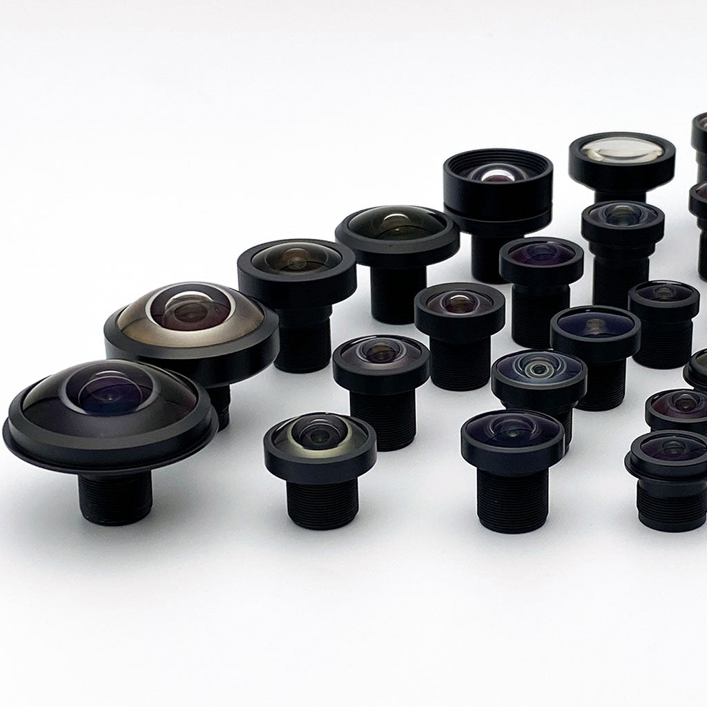
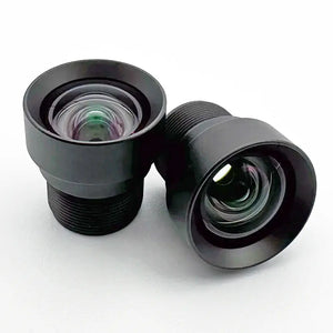
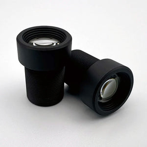
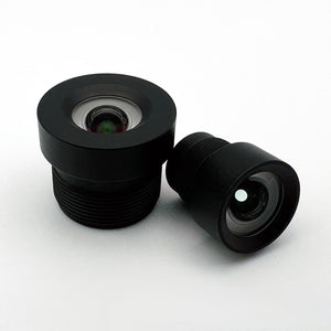
M12 lenses are the standard optic for drone and UAV cameras because weight is usually the binding payload constraint: Commonlands M12 lenses weigh 3-15g versus 50-200g for a comparable C-mount lens. The right lens then depends on the mission: low-distortion optics for mapping, wide field of view for FPV and obstacle avoidance, and sealed, thermally qualified construction where vibration and temperature swings matter.
Why M12 lenses are standard for drone cameras
M12 (S-mount) lenses dominate small drone and UAV cameras because flight time drops steeply as takeoff weight rises.
Weight, integration, and cost
On a 250g drone, swapping a 100g C-mount lens for a 5g M12 is the difference between flying and not. On larger platforms, the saved mass becomes battery or compute payload.
M12 lenses thread directly into a holder on the camera PCB, with no adapter or flange-distance requirement. The camera board and connector still need whatever enclosure the environment demands. Threading the lens in or out takes up the axial defocus from sensor stack thickness, though a thicker or higher-index cover glass can add spherical and chromatic aberration that refocusing cannot remove. For a plane-parallel plate with the same medium on both sides, the exiting ray is parallel to the entering ray.
| パラメータ | M12 (S-mount) | C-mount industrial |
|---|---|---|
| 標準重量 | 3-15g | 50-200g |
| マウント規格 | M12x0.5mm thread | 1"-32 UN thread, 17.526mm flange |
| Typical price range | $6-$99 (qty-dependent) | $200-$500+ |
| Max sensor coverage | Most models up to 1/1.8" (select designs to 2/3") | 最大1インチ以上 |
| アイリス制御 | Fixed aperture (typically no adjustable iris) | Manual or motorized iris available |
| IP-rated options | IP67/IP6K9K on select variants | Select ruggedized models only |
C-mount makes sense on a drone in narrow cases: large fixed-wing platforms with multi-kilogram payload budgets, or sensor formats larger than M12 can cover. See the M12 vs C-mount vs CS-mount guide for the full comparison.
M8 versus M12 for the smallest airframes
M8 lenses use an 8mm thread (commonly M8x0.5) for platforms where M12's front aperture and barrel volume are still too large. Otherwise M12 stays the better default for its wider sensor coverage and larger parts ecosystem. The M8 vs M12 section of the mount guide covers thread adapters.

Ground sampling distance and focal length selection
Ground sampling distance (GSD) is the ground distance covered by one pixel at a given altitude. For a mapping or survey drone, choosing focal length is an exercise in hitting a GSD target.
Flying twice as high doubles GSD. Doubling focal length halves it.
For example, take the Sony IMX577 (1.55µm pixel pitch) at 50m altitude: to hit 1cm GSD, focal length = (0.00000155 × 50) / 0.01 = 7.75mm. Use the field of view calculator or EFL calculator for your sensor.
| 用途 | Target GSD | Altitude range | Calculated EFL envelope | 注記 |
|---|---|---|---|---|
| Wide-area mapping | 3-5cm | 50-80m | 3-10.7mm | Maximum area per pass, regulatory ceiling permitting |
| Precision mapping / survey | 1-3cm | 30-80m | 3-32mm | Construction, survey, agriculture. Use a low-distortion lens |
| Close inspection | 0.5-1cm | 10-30m | 3-24mm | Tower, bridge, blade, and solar panel inspection |
| Long-range inspection | 0.5-2cm | 30-80m | 4.5-64mm | Standoff distance, telephoto tradeoff |
| FPV / obstacle avoidance | Not GSD-driven | Any | 1.9-4mm wide/fisheye | Field of view and reaction time matter more than resolution |
This GSD calculation gives the geometric sampling interval for a nadir view over flat terrain. Off-nadir tilt and terrain relief change sampling across the frame, and vibration, haze, motion blur, and lens MTF can make resolvable features larger than that sampling interval.
Distortion, mapping, and FPV lenses
Barrel distortion is the primary optical error that undermines aerial measurement accuracy. A few percent is tolerable in ground-based machine vision. In aerial photogrammetry, uncorrected distortion corrupts the geometry of orthomosaic maps and 3D reconstructions, so it has to be modeled out or kept low by design. Match the lens type to the mission, not the airframe.
For mapping and survey, prioritize low distortion
Photogrammetry software (Pix4D, Agisoft Metashape, OpenCV) estimates distortion as part of its camera model, so stable, calibrated distortion is modeled rather than fatal. Residual error tracks the quality of that solve. A standard wide-angle M12 lens often shows 10% or more optical distortion at the corners, which is a lot to ask of any calibration.
For photogrammetry, compare radial distortion at a stated image height and calibrate the complete camera. The CIL052 and sealed CIL034 variants are candidates, but their published distortion metrics differ. CIL034 lists 0.07% TV distortion at an 8.0mm image circle. That line-bow measurement is not a radial-distortion limit.
For FPV and navigation, prioritize field of view
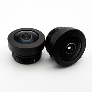
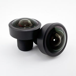
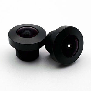
Obstacle avoidance and situational-awareness cameras benefit from wide or fisheye lenses (up to 230° field of view in the Commonlands catalog), because a larger visible scene gives more reaction time. Measurement accuracy is not the goal, so heavy barrel distortion is acceptable. Against a rectilinear reference, that distortion runs to tens of percent and approaches -100% at the edge of a 180° field, though datasheets often quote a smaller f-theta or TV figure, so check which reference a spec uses.
Reusing a fisheye lens for mapping
A fisheye lens can be reused for mapping after calibration and dewarping: the fisheye models in OpenCV, Pix4D, and Agisoft Metashape fit and rectify its projection. Dewarping resamples and stretches the edges, lowering effective edge resolution, so a low-distortion rectilinear lens still gives cleaner survey-grade measurements. See wide-angle and fisheye lens distortion and what is a low-distortion lens for the background.
Vibration and rolling-shutter interaction
Motor and frame vibration reaches the camera through the airframe, and how badly it shows depends on whether the sensor is global or rolling shutter.
Why rolling shutter makes vibration worse
A rolling-shutter sensor exposes rows sequentially, so a vibrating camera captures each row from a slightly different position during readout. The result is skew, wobble, or jello rather than simple blur. Skew scales with angular rate times readout time, so shorter readout, a global shutter, or better isolation all reduce it. See image sensor selection for machine vision for the full tradeoff.
What the lens can and cannot fix
Lens construction cannot eliminate vibration, but it changes how much reaches the elements. Rigid, all-metal barrels, including the Commonlands M12 line, are stiffer than plastic housings and help the lens and sensor hold alignment. Vibration-damping mounts between camera and frame are the first-line fix.
Thermal stability and sealed construction
Drone cameras face diurnal cycles plus rapid altitude-driven temperature swings and landing shock, and the lens must hold focus.
Thermal defocus at altitude
The atmospheric lapse rate at mapping altitudes accounts for a fraction of a degree. The larger effect is convective, as a sun-soaked housing sheds heat into faster airflow after takeoff.
A lens with plastic elements can drift focus with temperature. The allowed shift depends on the blur criterion. At low magnification, F/2 and a 3µm blur diameter give approximately ±6µm of geometric image-side focus tolerance. Construction is a shortlisting signal, not a number: drift depends on the prescription, glass and polymer dn/dT, barrel expansion, and athermalization, not on material class alone. Qualify it with a measured focus and MTF run over the flight temperature range. Commonlands can run that test on request.
A common starting point is to set fixed-focus cameras near the middle of the operating range and verify at both extremes, since drift is not always linear or symmetric. Bias that set point toward whichever end the mission spends most time at, or where the MTF budget is tighter.
Sealed construction for outdoor durability
A sealed lens barrel reduces moisture exchange during altitude cycling: an unsealed lens cooling at altitude can draw in humid air that condenses on internal glass and rarely clears without disassembly. IP67 (IEC 60529) covers dust and temporary immersion on the tested lens variant as mounted, not thermal cycling, condensation, or the rest of the camera.
IP6K9K (ISO 20653, often called IP69K) covers high-pressure jet washing, a separate test, not a higher grade, so a lens must be marked for both to claim both. Details in ruggedized machine vision lenses.
IR filters, NDVI, and multispectral imaging
The filter configuration of an M12 lens has to match the application, or images come out color-shifted or missing the needed spectral band.
The standard 650nm IR cut filter
The default for visible-light drone cameras, it blocks wavelengths above roughly 650nm, including the near-infrared that shifts color balance, particularly in foliage. Use it wherever color accuracy matters.
No-filter (NIR pass) lenses for NDVI and crop monitoring
Vegetation-health metrics need near-infrared reflectance: NDVI = (NIR − Red) / (NIR + Red). Healthy vegetation reflects NIR strongly while absorbing red, and a standard IR cut filter attenuates NIR too heavily to measure it. For agriculture and forestry work, specify an M12ANIR (no IR cut) variant and pair it with a filter that separates the red and NIR bands.
Even then, a single uncalibrated camera yields a vegetation-index proxy, not quantitative NDVI. That name takes the whole chain: defined red and NIR band responses, radiometric linearization, co-registered frames, irradiance normalization against a reference panel, conversion to reflectance, and validation against ground truth. Without the band separation, an unfiltered Bayer sensor mixes NIR into the red channel and the ratio loses its meaning.
850nm and 940nm bandpass filters for active IR
Night surveillance drones with an onboard 850nm or 940nm LED array benefit from a bandpass filter matched to the illuminator, rejecting ambient daylight and improving contrast. 850nm gives more sensor sensitivity. 940nm generally reduces visible red glow, though visibility depends on the emitter spectrum, intensity, and viewing conditions.
Calibrated multispectral imaging (RGB, red-edge, NIR) typically uses dedicated multi-sensor systems, not a single M12 lens. M12 lenses suit single-band NIR, NDVI-proxy setups, and active-IR night surveillance. Browse optical filters for bandpass options and bandpass filter selection for pairing guidance.
Top M12 lenses for drones by mission
The best M12 lens depends on the mission: a low-distortion lens for mapping and photogrammetry, wide field of view for FPV and obstacle avoidance, a telephoto for standoff inspection, and a no-IR-cut (NIR) variant for NDVI. Each figure is a published product-page spec. Size your choice against your sensor with the field of view calculator.
| Mission | レンズ | EFL | 歪み | 重量 | この選手を選んだ理由 |
|---|---|---|---|---|---|
| Precision mapping / photogrammetry | CIL052 | 5.2mm | <0.2% optical | <15g | Lowest distortion keeps orthomosaic geometry true, so lens calibration carries less of the load. |
| High-resolution mapping | CIL039 | 3.9mm | <0.2% TV | <15g | Resolves fine detail on 8MP and larger sensors at survey altitude. |
| Wide-area, weather-exposed mapping | CIL034 | 3.2mm | 0.07% TV at 8.0mm image circle | 5.7g | 102° covers more ground per pass, with IP67 sealing on the M12A variant (IEC 60529 dust and immersion). Construction is hybrid glass/plastic, so check its measured thermal focus shift against the flight temperature range. |
| FPV / obstacle avoidance | CIL337 | 3.6mm | Wide-angle, uncorrected | ~5g | 133° FoV at F/1.6 gives the most reaction time before an obstacle enters frame. IP6K9K sealed. |
| Forward navigation / general imaging | CIL355 | 5.5mm | Standard wide-angle | ~5.1g | 89° balances coverage and detail for a forward flight camera. IP6K9K sealed. |
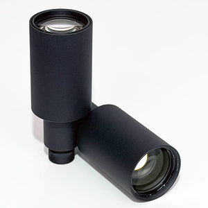
| Standoff inspection | CIL250 | 25mm | Telephoto, IR corrected | <15g | 20° diagonal at its 8.8mm image circle, narrower on a smaller sensor, holds working distance from towers, bridges, and wind blades. |
| NDVI / crop monitoring | CIL052 or CIL034 (M12ANIR) | 5.2mm / 3.2mm | Compare each product's metric. CIL034 is 0.07% TV at 8.0mm | <15g | The no-IR-cut variant passes the near-infrared band. Verify spectral transmission and calibrate geometry for canopy-area measurements. |
Weights shown with ~ are measured. Entries marked <15g are shortlisted by mass, not material: CIL039 uses a hybrid glass/plastic construction. Confirm the construction and exact mass of the selected variant on its product page. Optical and TV distortion are measured against different references and are not directly comparable.
When an integrated camera or another vendor fits better
For hobby FPV, an all-in-one like a GoPro or an M12 lens bundled with an Arducam or Sunex module is often the faster path. Optics, sensor, and tuning ship matched, and absolute distortion accuracy does not matter when the footage is only watched.
Spec-controlled lenses earn their place when the output is measured: orthomosaics, point clouds, GIS layers, or NDVI maps. These need a known focal length, a published distortion figure, and consistent unit-to-unit optics. Even then, calibrate each camera, or validate that one calibration transfers within your error budget: focal length, distortion, and principal point vary with assembly, and shift again on refocus or temperature change.

Technical references
よくある質問
What focal length M12 lens is best for drone mapping?
Choose focal length from target GSD and coverage. For example, 3µm pixels at 60m altitude need 9mm EFL for 2cm/px GSD. Then check sensor dimensions, distortion mapping, and MTF for that field. The CIL052 is one low-distortion candidate when its 5.2mm focal length meets those requirements. The 3.6mm CIL337 gives 133° of coverage for wide-area FPV and situational awareness, where reaction time matters more than geometry. Photogrammetry software solves a camera model either way. Low distortion makes that solve less load-bearing.
What is the lightest M12 lens for a drone camera?
The CIL337 (3.6mm) and CIL355 (5.5mm), both IP6K9K, weigh approximately 5g, against 50-200g for a comparable C-mount lens. On a 100-200g payload budget, that frees mass for battery, compute, or extra sensors.
Should I use an IR filter on my drone camera lens?
It depends on the application. For visible-light mapping, inspection, and photography, use a standard 650nm IR cut filter to keep color balance accurate. For NDVI and vegetation monitoring, specify a no-filter or NIR-pass variant. For active IR surveillance at night, match an 850nm or 940nm bandpass lens to your illuminator.
What M12 lens works for drone-based NDVI and crop monitoring?
Use a low-distortion M12 lens without an IR cut filter (the M12ANIR variants of the CIL052 and CIL034 are good starting points), paired with a filter that separates the red and NIR bands. NDVI = (NIR − Red) / (NIR + Red). Even then, a single uncalibrated camera yields a vegetation-index proxy for relative comparisons. Quantitative NDVI adds defined bands, radiometric linearization, co-registration, irradiance normalization, reflectance conversion, and validation. Without the band separation, an unfiltered Bayer sensor mixes NIR into the red channel and the ratio loses its meaning.
Do M12 lenses work with Raspberry Pi and Jetson cameras on drones?
Yes. Most small-format embedded camera modules use M12 (S-mount) lens holders: Raspberry Pi sells the official HQ Camera in both native M12-mount and C/CS-mount versions (the C/CS version includes a C-mount adapter), and Jetson-compatible MIPI modules and custom PCB cameras use M12×0.5mm thread as well. With no fixed flange distance, you set back focus with the lens thread.
Need help selecting a drone camera lens?
Contact Commonlands engineering for focal length, filter, and mounting recommendations based on your sensor, airframe, and flight profile.